To produce maps that depict current trends, cartographers collect information and conduct studies on the geographic characteristics of a given area. These maps are produced by cartographers for governments and businesses for political, cultural, and educational objectives using art, science, and technology.
In essence, cartography also referred to as geodata visualization, is the process of turning geographic and geospatial data into a map. Additionally, you’ll use spreadsheets, charts, and diagrams to show information.
For a variety of uses, from daily use by people to massive industrial expansion, maps, and comprehensive geospatial data are required. Nowadays, the job is dominated by the use of geographic information systems (GIS) and online mapping methods.
In this post, we go over what a cartographer is the process of becoming one, the typical wage in the country, and the future employment prospects for cartographers.
Who are cartographers?
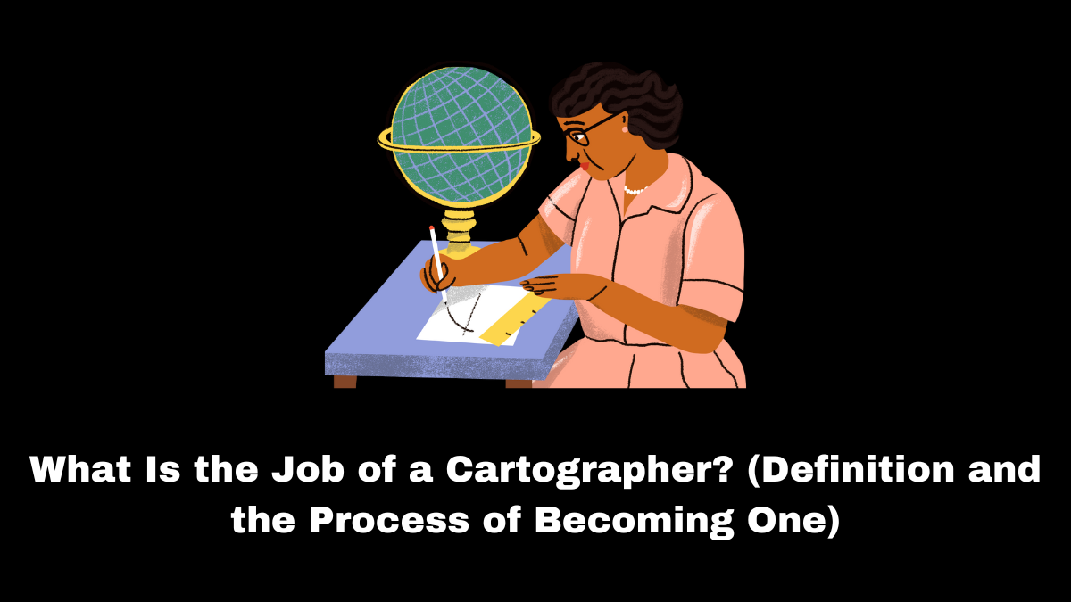
Those who create maps to convey spatial information are known as cartographers. They acquire information using geodetic surveys, satellite photos, and other techniques to support local and regional planning, as well as ecological health monitoring, by the government. Science, technology, and art are all incorporated into the study of cartography to portray a particular geographic area.
Cartographers produce printed or digital maps that show details about a location’s population size and demographics. These graphic aids assist in giving more details about a location. The maps can be used by governments and other institutions for published publications and resources like:
- Maps of the Archaeology
- Globes
- Nautical charts
- Military maps
- A road atlas
- Analytical charts
- Tourist guides

Types of cartographers
Cartography is the art and science of mapmaking. Cartographers are professionals who create, design and produce maps to visually represent geographic information. There are several types of cartographers, each specializing in different aspects of mapmaking and geographic representation. Some common types of cartographers include:
- General Cartographer: General cartographers create a wide range of maps that cover various topics, such as topographic maps, political maps, and thematic maps. They have a broad understanding of cartography principles and techniques.
- Topographic Cartographer: Topographic cartographers focus on creating detailed topographic maps that represent the physical features of the Earth’s surface, including contours, elevations, rivers, and mountains.
- Geographic Information Systems (GIS) Cartographer: GIS cartographers specialize in using Geographic Information Systems (GIS) software to analyze and visualize geographic data. They create digital maps and integrate data from various sources to generate geospatial insights.
- Cadastral Cartographer: Cadastral cartographers are involved in mapping land ownership and boundaries. They work with legal descriptions, property records, and land survey data to create cadastral maps used for property management and land registration.
- Thematic Cartographer: Thematic cartographers focus on representing specific themes or subjects on maps, such as population density, climate zones, transportation networks, or natural resources. They use various cartographic techniques to emphasize and communicate the chosen theme effectively.
- Marine Cartographer: Marine cartographers specialize in creating nautical charts and maps used for navigation at sea. They incorporate hydrographic data, tide information, and marine features to produce accurate and up-to-date charts for safe maritime navigation.
- Aeronautical Cartographer: Aeronautical cartographers create aviation charts and maps used by pilots and air traffic controllers. These maps include airport layouts, airways, airspace boundaries, and navigational aids for safe and efficient flight operations.
- Environmental Cartographer: Environmental cartographers focus on representing environmental data and spatial relationships. They create maps that illustrate patterns of environmental phenomena, such as climate change, pollution, habitat distribution, and ecological zones.
- Cartographic Illustrator: Cartographic illustrators are skilled artists who combine cartographic principles with artistic techniques to create visually appealing and informative maps. They use different styles, colors, and symbols to enhance map readability and aesthetics.
- Remote Sensing Cartographer: Remote sensing cartographers use satellite and aerial imagery to create maps and analyze changes in the Earth’s surface over time. They employ remote sensing technology to gather geospatial data and integrate it into map products.
These are just a few examples of the various types of cartographers. The field of cartography continues to evolve with advancements in technology and data visualization techniques, opening up new opportunities for specialized cartographic expertise.
Duties
To be a cartographer, you must:
- Data Collection and Analysis: Gather geographic data from various sources, such as surveys, satellite imagery, aerial photographs, and remote sensing data. Cartographers analyze and interpret this data to create accurate representations of the Earth’s surface.
- Map Design: Developing the layout and design of maps, considering factors like scale, projection, and the intended purpose of the map. They choose appropriate colors, symbols, and labels to communicate information clearly.
- Geospatial Data Integration: Integrating different types of geospatial data into maps, such as topographic features, land use, population density, transportation networks, and environmental information.
- Cartographic Visualization: Utilizing cartographic principles to visualize geographic data effectively. This includes representing elevation using contours, using different map projections to minimize distortion, and selecting appropriate symbols and colors.
- Geodatabase Management: Organizing and managing geospatial data in databases and GIS software for easy retrieval and updates.
- Quality Control: Ensuring the accuracy and precision of maps by conducting quality control checks and validating the data used in map production.
- Thematic Mapping: Creating thematic maps that focus on specific themes or subjects, such as climate, demographics, geology, or vegetation distribution.
- Updating and Maintaining Maps: Keeping maps up-to-date by incorporating new data and changes in the landscape.
- Cadastral Mapping: Working on cadastral maps that show property boundaries and land ownership information for legal and administrative purposes.
- Interactive and Web Mapping: Developing interactive and web-based maps that can be accessed and explored online.
- Map Publishing: Preparing maps for publication, whether in print or digital formats, ensuring they are visually appealing and accessible to the target audience.
- Collaboration: Collaborating with other professionals, such as surveyors, geographers, urban planners, and environmental scientists, to ensure that maps meet specific project requirements.
- Data Visualization and Analysis: Using GIS software and tools to analyze geographic data, perform spatial analyses, and generate insights from the data.
- Specialized Cartography: Some cartographers specialize in particular fields, such as marine cartography for nautical charts, aeronautical cartography for aviation charts, or environmental cartography for maps related to ecological and environmental factors.
- Develop maps, graphics, images, and layouts after researching to determine what should be on a map.
- Employing color, symbols, and design to convey information
- Create and build graphs using computers for both specialized and non-specialized users.
- Investigate, select, and assess map data sources to be used in the development or updating of charts and maps at different scales
- Mapping information for analysis and evaluation
- Communicate with customers about their needs and with outside contacts, like architects and designers, about the delivery of information; compile data from remote sensing methods.
- Run a stereoscopic or three-dimensional (3D) digital photogrammetric workstation (DPW) or photogrammetric plotting instrument (PGI).
- Create, manage, and modify geographical information (GI) databases using geographical information systems (GIS) to visualize, model, and analyze landscape features
- Modify and synthesize information using desktop publishing programs to acquire, preserve, and output electronic geospatial information
- Generalize map data to enable scale reduction (derived mapping)
- Verify the information on maps, charts, and printing samples.
At the senior level, you must:
- Accept accountability for a variety of products (or all if it’s a small business)
- Control spending, hiring, and production plans
- Price new business
- Communicate with customers and other divisions.
The duties of a cartographer require a deep understanding of geographic principles, cartographic techniques, and proficiency in using GIS software and other mapping tools. Attention to detail, critical thinking, creativity, and effective communication skills are also essential for producing accurate and visually appealing maps that effectively convey information to their intended users.
What is the work of a cartographer?
A cartographer is involved in all stages of the creation of a map, including research, design, production, and distribution. Some of a cartographer’s duties could be:
- Gathering and analyzing geographic information, like yearly perceptual trends
- Creating thematic maps by analyzing and compiling information from field research, aerial photography, reports, and satellite pictures
- Creating a themed map in digital or graphic versions for corporate, social, academic, or environmental reasons.
- Examining and verifying the accuracy of maps
- Updating existing maps to reflect corrections or modifications
What qualifications are needed for the position of cartographer?
A gratifying career that contributes to the dissemination of crucial geographic knowledge can be found in cartography. The following are some prerequisites to becoming a cartographer:
Education
Obtaining a bachelor’s degree is the minimally acceptable academic requirement for cartographers. Most cartographers have a background in surveying, geography, geoscience, or another related area. Students frequently pursue specializations in geographic information systems (GIS), the computers that cartographers use to record and process the data they collect.
License
Based on the state, certain cartographers might need to obtain a surveyor license. This title displays their expertise in land surveying, a technique they employ when gathering information for maps. State-specific qualifications for licensed surveyors vary but typically include having prior job experience and passing several exams.
The Fundamentals of Surveying (FS) exam, Principles and Practice of Surveying (PS), and your state-specific examination must all be passed to obtain a surveyor license. These tests are given by the National Council of Examiners for Engineering and Surveying. The FS exam can be taken in college, while the PS exam can wait until the candidate has completed the necessary four years of professional experience.
Skills
Cartographers acquire skills that enable them to do their jobs well through their training and instruction. Below are a few abilities that productive cartographers have:
- Critical analysis: Cartographers can assess the truthfulness of themes in contemporary maps, surveys, or other records by applying analytical thinking.
- Observation of details: Cartographers are detail-oriented researchers and data collectors who pay special attention to every bit of data when assembling their maps.
- Data assembling: To generate maps and provide answers to queries, cartographers need to have a solid understanding of how to collect and measure information.
- Making decisions: Cartographers must be able to make choices that will best serve their client’s needs and incorporate all relevant data.
- Design: Cartographers utilize spatial perception and color symbolism to plan and create the visual appeal of their maps.
- Knowledge of technology: Cartographers employ mapping software and a variety of tools, including scanners. Because many cartographers create web maps, having an understanding of coding languages like JavaScript is advantageous.
Professional experience
Employers often favor applicants with three to five years of job experience minimum. In the beginning, many cartographers work as specialists in mapping or surveying. As they develop expertise, they could advance to the position of a cartographer, where they ultimately get to decide on the layout and style of a map.
Certification
To demonstrate to hiring managers their extra specialized skills, cartographers might obtain optional certificates. After passing an exam, you can obtain several different certificates from the American Society for Photogrammetry and Remote Sensing. These accreditations consist of:
- GIS/LIS Technologist Certification
- Map Scientist certification
- Remote Sensing Mapping Scientist Certification
What kind of setting do cartographers operate in?
Most cartographers are employed by local, state, or federal governments. Along with providing architectural or engineering services, they might also work for consulting firms that provide scientific, management, or technological advice. Additional employers encompass:
- Publishers of commercial maps
- Local government
- Independent consulting
- Service providers
- Utility providers
The majority of a cartographer’s work is done in an office, accompanied by sketching tables, computerized mapping systems, and other ancillary tools. To obtain information, they may occasionally travel to the place they are researching. A cartographer often puts in 40 hours per week at their regular job.
What occupations are comparable to those of a cartographer?
Several additional professions closely involve geographic data in addition to cartography. A geospatial analyst is someone with a similar profession who studies geographic records to follow the evolution of past landscapes and aid in future planning. A GIS professional, who creates databases and processes for collecting geographical data, has a similar role. Photogrammetrists collect information from real-world objects, much like cartographers do, to identify trends and patterns.
What is the yearly pay and employment forecast for cartographers?
In the US, the average salary for a cartographer is $72,918. Salary varies according to an individual’s level of expertise and the geography of their place of employment.
According to the U.S. Bureau of Labor Statistics, jobs for cartographers are expected to increase by 4% over the next ten years, which is faster than the average development rate for all other professions. According to BLS, increased use of maps in state planning could lead to an increase in employment. The use of cartographers to identify places in need of assistance following natural disasters may potentially grow in popularity.
Salary
Typical starting salaries fall between £18,000 and £22,000.
- You can make between £20,000 & £30,000 with expertise.
- You will normally make between £30,000 and £47,000 at the senior level.
A cost will be negotiated with the customer by seasoned cartographers acting as consultants based on their reputation and experience.
The income statistics are simply meant to be a guide.
Hours of work
Typically, you’ll work during regular business hours (9 am to 5 pm, Monday to Friday). However, to fulfill publishing or project completion deadlines, you might have to put in more time.
How to prepare
- Jobs are accessible across the country; however some positions, like those in government agencies, are concentrated in the area around London and the southeast.
- The majority of jobs are office-based, and meeting deadlines for projects requires you to appreciate working in a team.
- You might be able to transition into consulting employment as you gain experience. Few seasoned cartographers go on to find and manage their businesses.
- It might be advantageous to be geographically flexible, especially when seeking your initial job or while trying to advance your career.
- Your cartographic abilities can be put to use abroad.
Qualifications
You’ll likely require a degree in geospatial science because there are no undergraduate programs that specialize specifically in mapping. Suitable topics include:
- Natural sciences
- Science of geospatial information
- Geospatial information systems
- Systems for geographical information (GIS)
- Geology and geography
- Geographic information systems (GIS)
- Surveying of land
- Geospatial data science and mapping
- Oceanography.
Software engineering, computer science, and design are further relevant fields of study. Look for programs that provide cartography-related modules or courses.
A postgraduate degree may be beneficial for future professional advancement and for allowing you to join a more specialized field of work. There are postgraduate programs offered in subjects like:
- Geography-based information systems (GIS)
- Mapmaking and geoinformation technology
- Mapping and geospatial sciences
- Photogrammetry
- Remote monitoring
- Surveying.
Furthermore, after graduating from high school or college or after completing an apprenticeship, one might enter the field of cartography as a trainee technician. Math and English language GCSEs (or equivalents) are required for employment in the public sector, while geography is occasionally favored. You must have at least five GCSEs, including math and English, and two A-levels to be eligible for entry at the upper level.
A helpful Professionals page on the webpage of the Royal Geographical Society and Institute of British Geographers provides details about Chartered accreditation and career advancement. It also includes a Geovisualization page that displays the many methods through which geographers present data.
Professional experience
Since there are no specific degree programs in cartography, you will typically need to find employment first and then undergo training there. It can be beneficial to have real-world experience earned through internships or a year of work experience required for your degree. Large companies like Ordnance Survey (OS) provide summer placements and internships.
It’s helpful to compile a portfolio of your design concepts and/or maps for the interview.
Employers
Either the government sector or private mapping firms employ cartographers. These are the biggest companies in the public sector:
- Land & Property Services Northern Ireland
- Hydrographic Office,
- Ordnance Survey
The Geospatial Graduate Program and the Data and Technology Graduate Program are two graduate programs run by Ordinance Survey. Information about both is available on the Career page.
The Department of Environment, Food and Rural Affairs (DEFRA), Rural England, Natural England, the Forestry Commission, and the Department of Transport are additional government agencies that occasionally may provide career opportunities.
You might also work for local governments’ planning divisions or specialized organizations like the James Hutton Institute, British Antarctic Survey, and British Geological Survey.
Cartographers are also employed by the Royal Air Force and the British Army as air cartographers and geographical technicians, respectively.
Regular employers in the business sector include:
- Cartographers with a publishing background
- Firms that provide utilities like power, gas, and water
- Oil businesses
- GIS businesses
- Land and aerial surveying firms
- Ecological or planning consultancy.
You can also work as a freelance cartographer after gaining experience.
Look for open positions at:
- UK Cartographic Society
- Civil Service Positions
- Listings of discussion groups, like BCS Forum and LIS-MAPS
- Websites of organizations both in the public and private sectors that hire cartographers.
University departments that provide degrees in GIS or related fields may be contacted by employers with open positions. Pay close attention to job descriptions because not all positions are marketed as “cartographers.”
Since there aren’t many people working as cartographers, networking and word-of-mouth referrals are important in the job search.
Career growth
In-house and on-the-job training is common. You’ll concentrate on gaining practical abilities in areas like:
- Assembling maps
- Map design and construction
- Map creation (a variety of software programs).
In a larger organization, you may get the chance to work in a variety of departments and hone your talents in specialized fields like GIS, photogrammetry, and electronic mapping. Additionally, you might get outside instruction in particular software programs.
Smaller businesses could have less funding for training, but they might also have more interesting projects for you to work on as you develop your abilities.
If you do not already possess a Master’s degree, employers may also support your postgraduate studies. Ask potential employers whether there are any prospects for training and career advancement.
Joining The British Cartographic Society is beneficial for networking with professionals and exchanging knowledge at conferences and events. On its website, there are also career biographies that describe various professions.
The International Map Industry Association (IMIA) offers the chance to connect with others and exchange information through its extensive membership. The BCS Forum is a helpful platform for exchanging knowledge and developing new skills.
Career opportunities
Career advancement is somewhat influenced by your characteristics and drives in addition to the size, structure, and type of the company you work for.
A systematic promotion route is more probable to exist if you work in the public sector. With more experience, you can advance through the ranks, assuming more accountability for decisions and projects as well as for less experienced workers. Additionally, there can be additional chances to move to different areas of the company.
To advance in a small business, you might need to be regionally adaptable. You might, however, discover the task to be more engaging and varied. Given that several commercial cartography businesses are part of a larger company, you might find prospects there.
There may be chances to specialize in fields like desktop publishing, photogrammetry, 3D visualization, GIS, or photogrammetry, which can lead to more opportunities.
Experienced cartographers can also go into self-employment by offering a specialized service or product to other cartographic businesses or publishers.

Conclusion
Map creation is a specialty of cartographers. They create a publishable map by gathering and analyzing geographic data.
Ultimately, cartography is a blend of technology, science, and art. In this way, cartographers appreciate and find their work to be challenging.
Jobs that simply involve cartography are getting harder to find. Finding work solely in cartography is challenging because you’ll need to have expertise in other areas as well.
However, a modern cartographer is still required to convey information graphically and tell a story.
Frequently Asked Questions about Cartographers
- What exactly does a cartographer do?
For both government sector and corporate customers, cartographers research, plan, create, and disseminate digital and analog maps, charts, tables, and diagrams.
- Do cartographers employ mathematics?
Cartographers benefit from math when it comes to coordinate systems, map projection, and scale. A topographic map is a ratio or percentage between the measurements on a map and their equivalent distances on the surface of the world. Coordinate systems use numbers to represent places on the surface of the world.
- What issue confronts cartographers the most?
A segment of the sloping surface of the earth must be represented on a flat sheet of paper without adding any more deformation than is strictly necessary. This is the main challenge in mathematical cartography.